These Boots are Made for Walking: Counting Down the Days!
.") The founder of Taoism, Lao-tzu, is attributed with saying “The longest journey begins with a single step.” My journey began around 2000 when I was first introduced to the Camino de Santiago by Shirley Maclaine’s book, The Camino. I was intrigued by her accounts of a self-discovery pilgrimage.
The founder of Taoism, Lao-tzu, is attributed with saying “The longest journey begins with a single step.” My journey began around 2000 when I was first introduced to the Camino de Santiago by Shirley Maclaine’s book, The Camino. I was intrigued by her accounts of a self-discovery pilgrimage.
Maclaine wasn’t the first person to travel that Pilgrimage and I won’t be the last. For the last 1000 years, people such as St. Francis of Assisi, Charlemagne, Ferdinand and Isabella, Dante and even Chaucer have taken the journey.
Most people walk the distance in 28 to 42 days. I will be taking my time and staying at least 40 days.
I’ve asked myself several times, “Why am I so interested in walking 500 miles, alone, in a country 4,000 miles away from home?” My Spanish is nonexistent. Almost 50 years ago, I had one year of Spanish in high school.
I’ve always been fascinated with other cultures and travel. I’ve fed that attraction with many trips to numerous countries. I’ve hosted people from several counties and have been a guest of others in foreign lands.
A vivid memory from my early childhood was my owning a book titled The Wanderlust. I don’t know how I acquired it and I don’t remember the plot. I’ve searched on-line, hoping to find a clue to the allure, but haven’t found anything that resembles that particular book.
Why? Could it be something about Maya Angelou’s passage? “Perhaps travel cannot prevent bigotry, but by demonstrating that all peoples cry, laugh, eat, worry, and die, it can introduce the idea that if we try and understand each other, we may even become friends.”
Traditionally, as with most pilgrimages, the Way of Saint James or the Camino de Santiago, begins at home and ends at the final destination site. To me, a pilgrimage is more than just the miles one walks on the actual route. I can attest to the fact that the journey begins at conception by the 8 months I have spent, and the 3 months more that I need, to get ready for this walk; not counting the years that the seed has been germinating in my heart and head. It has already been a journey in and of itself; just the soul-searching alone could be termed a pilgrimage.
I’ve given hours and hours to internet searches and I’ve read several books, including A Pilgrims Guide to The Camino de Santiago by John Brierley, To Walk Far, Carry Less by Jean-Christie Ashmore, Eyewitness Travel ‘s Northern Spain, and one book that was so boring I gave it away and don’t remember the name or author. When The Way came out, a 2010 American film with Emilio Estevez and his father Martin Sheen, I was beside myself with excitement. It was such a small budget, small release film that I missed it in the theatres, but was so happy to buy it on DVD two years ago.
My tickets to Spain, in early May, are ready and waiting. I have a reservation for a two-night stay at a hotel when I arrive in Pamplona, known here for Hemingway and the Running of the Bulls. I’ll need to get over jetlag and I want some time to see the city before I set out on foot.
I’ve gone against my frugal nature of walking around town, several days a week, and have joined the Carroll Wellness Center. I need upper-body strength to carry a 20-pound backpack and have it less burdensome. I’ve followed all the sales at REI and made three trips to Greensboro, the nearest REI store, to reequip my hiking supplies. My boots are 20 years old and the sole is about to come off. Five-hundred miles with less than wonderful hiking boots-I don’t think so!
The main pilgrimage route to Santiago, since the Middle Ages, follows an earlier Roman trade route. There are more than a dozen routes that converge at Saint James’ tomb in western Spain. Many people walk the Way for religious reasons. Many hikers walk the route for non-religious reasons such as travel, sport, or the challenge. Part of my fascination and determination is to experience a spiritual adventure and to distance myself from the hustle and bustle of everyday life. Part of my resolve is to stay as young as possible, both mentally and physically. This segment of my life should provide proof of my mental and physical competences, one way or the other.
The Camino’s accommodations are unique with pilgrim hostels (albergues) which allow pilgrims to sleep in dormitory-style accommodations for as little as €3-10 ($4-14) per night. A good reason to go in May is to avoid the college kids that frequent the trail in the summer months. By all accounts, there are pilgrims of all age groups. Pilgrim menus are served in restaurants and sometimes at the hostels and are reasonably priced to accommodate the cathartic adventure.
To prevent misuse of the 1000-year old spirit of hospitality at the refugios, a stay is limited to those carrying proof of their intentions. One small indication that a person is a perigrino (pilgrim) is the iconic symbol of the scallop shell carried by the traveler. There are many accounts as to why this item is symbolic, but one source suggests the grooves in the shell meet at a single point that represent the various routes traveled, arriving at a single destination: the tomb of James in Santiago de Compostela.
Authentic pilgrims carry a credencial, a pass which gives access to the inexpensive and sometimes free, accommodation. The credencial is stamped at each hostel along the way.
Once you reach the Santiago de Compostela Cathedral, after a ritual visit to Saint James’ tomb, you may present your credencial and petition for a compostela, a certificate of accomplishment, written in Latin, given to pilgrims completing the Way.
How will I feel after spending that many days away from family, away from the familiar? Will I want to take up where I leave off? Will my life ever be the same?
Follow my progress as I blog about this journey at www.penelopesart.com. I also have a pencil and a beautiful new lightweight leather journal that my good friend gave me for the trip in which I will attempt to record my thoughts for later reflections.

[`google_buzz` not found]
[`yahoo` not found]
[`livedoor` not found]
[`friendfeed` not found]
[`tweetmeme` not found]
Camino de Santiago or Bust!
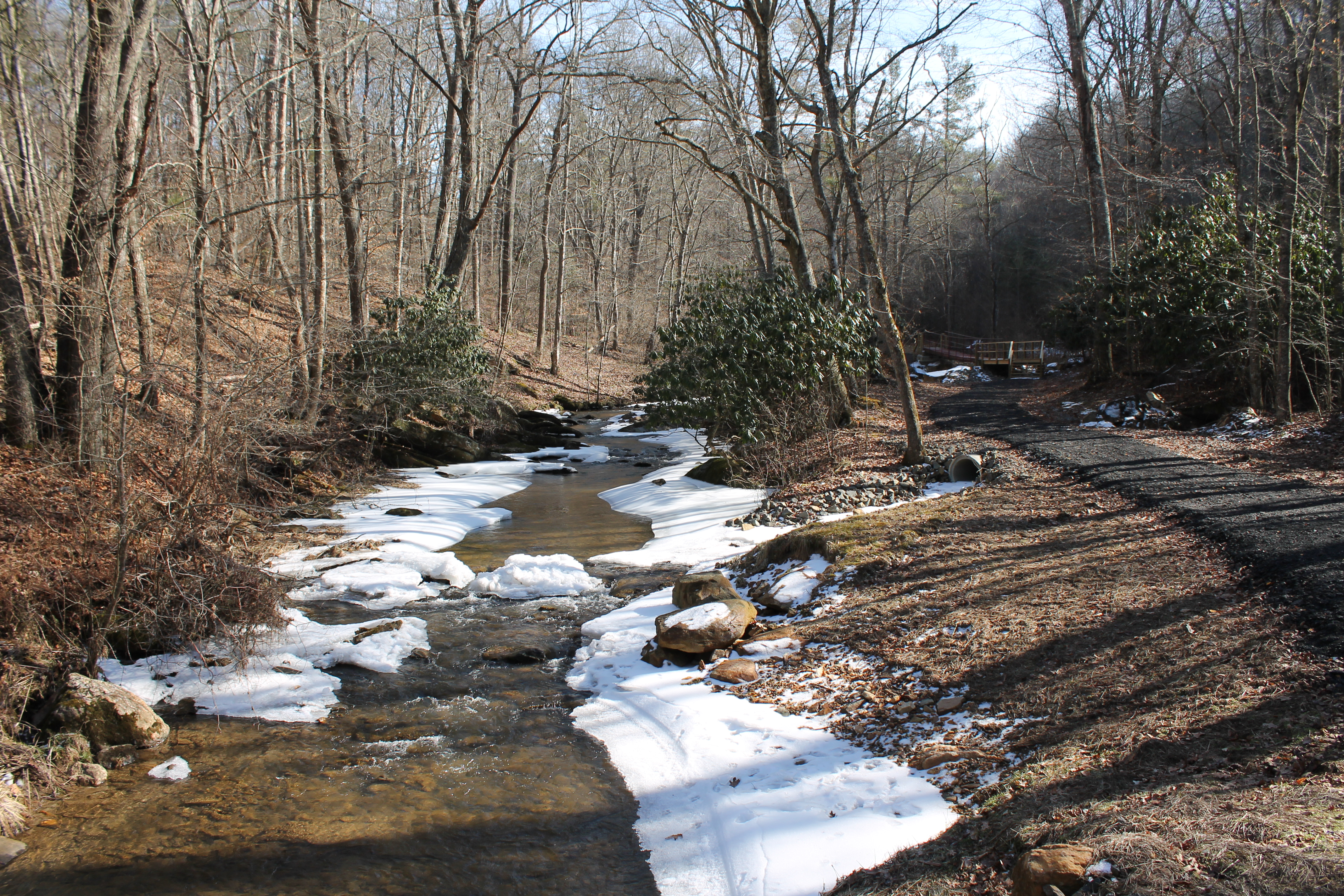 The Beaver Dam Walking Trail slipped on a new pair of waterproof boots.
Thank you to the Town of Hillsville for recognizing the issues of a trail under water and making the much-needed improvements that were recently completed after seven months of work. This is a trail that can, once again, be enjoyed by hikers, birders and nature lovers of all ages. The trail is open every day from sunup to sundown.
I am especially pleased with the improvements at this time in my life. I have spent years getting ready for a pilgrimage of a lifetime. This trail is my answer for preparation of my actual trek in the days leading up to the trip. Traditionally, a pilgrimage begins at home and ends at the final destination site. My destination is a 500-mile spiritual walk across northern Spain, beginning in May, the Camino de Santiago (The Way).
I can attest to the fact that this journey began at conception. I’ve given hours and hours to internet searches, I’ve read several books on the subject, and I’ve reequipped my hiking supplies. I’ve gone against my frugal nature of walking outside on good-weather days and have joined the Carroll Wellness Center. I need upper-body strength to carry a 20-pound backpack.
The Wellness Center’s therapy pool and sauna are great to lessen the stresses of exercising. The modest fees are some of the best money I’ve spent in a long time. However, I have to say that the long walks in town, extended to the Beaver Dam Walking Trail, are even better.
Armed with a camera, water and sandwich, I set out for an easy 6-mile walk on one of the first few pleasing days that Hillsville had experienced this winter. I was pleasantly surprised to have clear blue skies and fifty-degree temperatures instead of rain that had been forecast.
The sidewalks of downtown Hillsville offer a pleasant walk past friendly residents and shopkeepers. For the most part, motorists yield at the right of ways for pedestrians. I started out on South Main Street, where the sidewalk ends, and walked to Rt. 886 or Beaver Dam Road on North Main Street, turned right and walked for 0.5 miles to the northern entrance of the Beaver Dam Trail.
The last time I walked the northern end of the trail, I was knee deep in mud from the damages of flooding and downed trees that severe storms created over the years.
Built originally in 2002, along the Beaver Dam Creek, the 3.32-mile trail is part of the statewide Birding and Wildlife Trail system of the Virginia Department of Game and Inland Fisheries, and is also part of the Mountain Warbler Trail loop.
The contrast of sidewalk to trail, cityscape to nature-scape, and people to animals is psychologically powerful when you drop down the staircase from Beaver Dam Road onto the trail. The creek beside open fields meanders through some riparian habitat. A big portion of the trail is set between tall hills and a canopy of hardwoods. On this particular day, after a rainstorm, birds were chirping loudly and the rushing water was competing with the howling wind.
I spotted deer tracks. That is not so unusual because deer are so abundant in the community that I have to run them out of my backyard on South Main Street. I’m waiting to see the families of wild turkey foraging along the edges of the fields or the frogs and salamanders that are so common in and around the creek.
The switchback of the elevated seven bridges along the trail adds man-made beauty, almost sculptural, with decking and stairs frozen against the ice floats below. The trail on the Upper Beaver Dam is now made of roadway millings. Although lumpy, it is very comfortable to walk on. My waterproof, mid-cut hiking boots, while not necessary, are a good fit to prevent twisted ankles.
There is a new shelter constructed at the trail’s halfway point. I imagine it would be nice if one was caught in a downpour. I enjoy the benches and trashcans dispersed at convenient points along the way. To sit and enjoy a sandwich, listen to nature’s music, and see birds flitting about gives me the energy to finish the journey.
There are no restrooms or porta-potties on the trail, but near the end of the 3.32-miles, you wind past the Carroll Wellness Center. What a relief! Member or not, they will allow you to use their restroom.
After that break, I continued up the steeper part of the trail. I chose this north-to-south route for one reason. Climbing and stopping, climbing and stopping, catching my breath alone in the woods is much better than a south-to-north route where I would be on a public highway, stopping and climbing, stopping and climbing. Someone may see me and think I need an ambulance.
A beautiful part of the trail is paved and in the Carter Pines Community Park that traverses through the towering Carter Pines and by the Carter Hydraulic Water Rams, dating back to 1924 and listed on the National Register of Historic Places. The Rams were built by the Industrialist, George Carter, for his personal use and are preserved by Carroll County. There are several educational way-markers on this short section. Stop, read, and climb. Stop, read, and climb. Perfect for the heart and lungs.
The trail comes out at the rear of the Carroll County Courthouse on the Carroll County Sheriff’s Office side. I caught my breath one last time on the bench of the deck, with a beautiful view of distant mountains, before I hiked on through the parking lot and beside the historic Carroll County Courthouse. I turned left onto Main Street once more.
It was downhill from here. I made it! The third time in as many days, with many, many more treks to come. Next time I’m parking my car at the Carroll Wellness Center and walking to South Main, back to North Main and along the trail for what I’m estimating to be almost 7 miles. I’ll end that hike with a soak in the therapy pool. Thank you Hillsville and all those other donors who have created a wonderful place to lose yourself on a nature trail and to prepare for other, longer travels.
The Beaver Dam Walking Trail slipped on a new pair of waterproof boots.
Thank you to the Town of Hillsville for recognizing the issues of a trail under water and making the much-needed improvements that were recently completed after seven months of work. This is a trail that can, once again, be enjoyed by hikers, birders and nature lovers of all ages. The trail is open every day from sunup to sundown.
I am especially pleased with the improvements at this time in my life. I have spent years getting ready for a pilgrimage of a lifetime. This trail is my answer for preparation of my actual trek in the days leading up to the trip. Traditionally, a pilgrimage begins at home and ends at the final destination site. My destination is a 500-mile spiritual walk across northern Spain, beginning in May, the Camino de Santiago (The Way).
I can attest to the fact that this journey began at conception. I’ve given hours and hours to internet searches, I’ve read several books on the subject, and I’ve reequipped my hiking supplies. I’ve gone against my frugal nature of walking outside on good-weather days and have joined the Carroll Wellness Center. I need upper-body strength to carry a 20-pound backpack.
The Wellness Center’s therapy pool and sauna are great to lessen the stresses of exercising. The modest fees are some of the best money I’ve spent in a long time. However, I have to say that the long walks in town, extended to the Beaver Dam Walking Trail, are even better.
Armed with a camera, water and sandwich, I set out for an easy 6-mile walk on one of the first few pleasing days that Hillsville had experienced this winter. I was pleasantly surprised to have clear blue skies and fifty-degree temperatures instead of rain that had been forecast.
The sidewalks of downtown Hillsville offer a pleasant walk past friendly residents and shopkeepers. For the most part, motorists yield at the right of ways for pedestrians. I started out on South Main Street, where the sidewalk ends, and walked to Rt. 886 or Beaver Dam Road on North Main Street, turned right and walked for 0.5 miles to the northern entrance of the Beaver Dam Trail.
The last time I walked the northern end of the trail, I was knee deep in mud from the damages of flooding and downed trees that severe storms created over the years.
Built originally in 2002, along the Beaver Dam Creek, the 3.32-mile trail is part of the statewide Birding and Wildlife Trail system of the Virginia Department of Game and Inland Fisheries, and is also part of the Mountain Warbler Trail loop.
The contrast of sidewalk to trail, cityscape to nature-scape, and people to animals is psychologically powerful when you drop down the staircase from Beaver Dam Road onto the trail. The creek beside open fields meanders through some riparian habitat. A big portion of the trail is set between tall hills and a canopy of hardwoods. On this particular day, after a rainstorm, birds were chirping loudly and the rushing water was competing with the howling wind.
I spotted deer tracks. That is not so unusual because deer are so abundant in the community that I have to run them out of my backyard on South Main Street. I’m waiting to see the families of wild turkey foraging along the edges of the fields or the frogs and salamanders that are so common in and around the creek.
The switchback of the elevated seven bridges along the trail adds man-made beauty, almost sculptural, with decking and stairs frozen against the ice floats below. The trail on the Upper Beaver Dam is now made of roadway millings. Although lumpy, it is very comfortable to walk on. My waterproof, mid-cut hiking boots, while not necessary, are a good fit to prevent twisted ankles.
There is a new shelter constructed at the trail’s halfway point. I imagine it would be nice if one was caught in a downpour. I enjoy the benches and trashcans dispersed at convenient points along the way. To sit and enjoy a sandwich, listen to nature’s music, and see birds flitting about gives me the energy to finish the journey.
There are no restrooms or porta-potties on the trail, but near the end of the 3.32-miles, you wind past the Carroll Wellness Center. What a relief! Member or not, they will allow you to use their restroom.
After that break, I continued up the steeper part of the trail. I chose this north-to-south route for one reason. Climbing and stopping, climbing and stopping, catching my breath alone in the woods is much better than a south-to-north route where I would be on a public highway, stopping and climbing, stopping and climbing. Someone may see me and think I need an ambulance.
A beautiful part of the trail is paved and in the Carter Pines Community Park that traverses through the towering Carter Pines and by the Carter Hydraulic Water Rams, dating back to 1924 and listed on the National Register of Historic Places. The Rams were built by the Industrialist, George Carter, for his personal use and are preserved by Carroll County. There are several educational way-markers on this short section. Stop, read, and climb. Stop, read, and climb. Perfect for the heart and lungs.
The trail comes out at the rear of the Carroll County Courthouse on the Carroll County Sheriff’s Office side. I caught my breath one last time on the bench of the deck, with a beautiful view of distant mountains, before I hiked on through the parking lot and beside the historic Carroll County Courthouse. I turned left onto Main Street once more.
It was downhill from here. I made it! The third time in as many days, with many, many more treks to come. Next time I’m parking my car at the Carroll Wellness Center and walking to South Main, back to North Main and along the trail for what I’m estimating to be almost 7 miles. I’ll end that hike with a soak in the therapy pool. Thank you Hillsville and all those other donors who have created a wonderful place to lose yourself on a nature trail and to prepare for other, longer travels.
[`google_buzz` not found]
[`yahoo` not found]
[`livedoor` not found]
[`friendfeed` not found]
[`tweetmeme` not found]
Poetically Limerick
Wednesday, October 3, 2013
Another “Committee-Decision” day. Our schedule was to travel south to visit Killarney National Park and maybe take a short hike around the 26,000 acres. Instead we set out for Limerick, a short 50 mile drive north. The drive there was a piece of cake on a major interstate, but getting around the heavy traffic in the city was another story. We stopped and asked directions for the historic center and we turned around a couple of times. Once we arrived at the parking garage near the visitor center, we were good to go.
When we talked about visiting Limerick, I kept thinking in my head about a limerick or a verse and wondered if there was a connection. Wikipedia says the term's connection with the city is obscure, but the name is thought to be a reference to Limerick City or County Limerick. These days many people think of Frank McCourt's memoir Angela's Ashes when they think of Limerick City. Unfortunately, we didn’t have time to visit his museum.
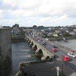
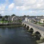
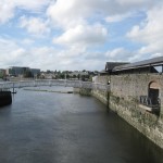
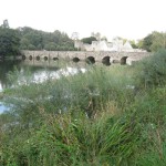
Limerick City, the third most populous urban area, is on the River Shannon. The historic part of the city is located on King's Island, surrounded by the Shannon and the Abbey River. History suggests the presence of earlier settlements in the area surrounding King's Island but the year 812 is the earliest recorded settlement when the Vikings sailed up the Shannon and pillaged the city but were forced to flee when the Irish attacked.
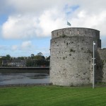
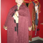
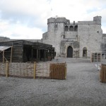
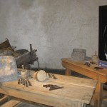
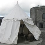
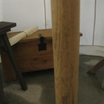
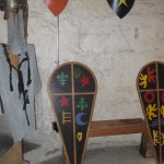
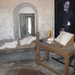
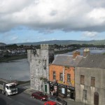
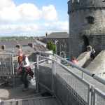
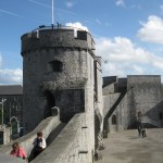
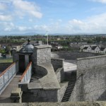
We all started the tour with a walk from the Visitor’s Center to King John's Castle, a 13th century castle that dates back to 922. The Vikings lived on the Island previous to the castle being built by King John in 1200 to protect the city from the Gaelic kingdoms to the west and from any rebellion by Norman lords to the east and south. It is said to be one of the best preserved Norman castles in Europe. The walls, towers and fortifications are in good shape today. We were really impressed with the site and loved the full-scale computer screens in the exhibits. A costumed actor on the screen would play his historically correct part, talking about the display in the room. It felt that his eyes were following you around the room. We spent too much time in the museum reading all the information and trying on medieval clothes. I found out later that between 2011-2013 the castle underwent a massive redevelopment to improve the visitor facilities with a brand new visitor center, interactive exhibitions with computer-generated animations and a cafe with views onto the courtyard and the river. We sampled the food at the café. It was good, but later when we visited the Hunt Museum and saw their restaurant, we wished we had waited like John, Pat, Rob and Harriet had.
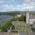
On the walk to King John’s Castle, we passed St. Mary’s Cathedral and noticed a sign that read “Free Lunchtime Concert”. This free concert was part of a Wednesday series and today was Wednesday. After grabbing a bite at King John’s, half of us went to the concert. St. Mary’s was founded in 1168 and is the oldest building in Limerick in daily use. It has the only complete set of misericords (mercy benches) left in Ireland. We heard Peter Barley, organist, play music by J.S. Bach and Cesar Franck in this beautiful setting. The music bellowed through the grand building as we sat fixated in another world. I noticed a huge crack in the wall as I was leaving and had a sigh of relief that I was on the outside looking in.
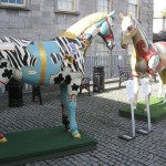
On our walk around town, we noticed two beautifully decorated, life-size horses standing in front of a stunning building. On closer inspection, it was the Hunt Museum. We all agreed to check it out and who but our wondering eyes should appear-The Meineckes and the Carrickers. We were so blessed to run into them. It was almost time to meet back at the designated area and none of us had seen all we wanted to see. The best part was that they had just started a private tour of the museum and we were able to join in. The Hunt Museum opened in 1978 to house an internationally important collection of approximately 2,000 works of art and antiquities collected by John and Gertrude Hunt. I really enjoyed the tour. The guide was really informative. I found one painting that I was especially taken with painted by Sean Keating (1889-1977). I didn’t know his lively, vibrant work but vowed to look him up and learn more.
I grabbed a coffee to go in the café of the museum, wishing I had time to sample some of their delicious looking deserts and entrees. John and Pat had eaten there and said it was wonderful. We traced our route backwards out of town, the route that had left us befuddled on the way into the city and arrived back to Dromcollogher and Springfield Castle without incident.
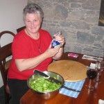
Carol, being from Texas, wanted to buy the ingredients to make us a real Tex-Mex dinner. We stopped at the huge supermarket in the illustrious town of Newcastle West on the way home. I say illustrious because Newcastle West is the town in which we inevitably missed our turn each time we went through it. This was our turning point off highway N21 onto a smaller local road that took us to Dromcollogher. We were apprehensive about being able to find this large market again. I guess fifth time is a charm because we found the market and Carol found everything she needed. That night was one of our most fun evenings at the castle. Everyone pitched in with Carol’s directions and we all ate like cowboys after a long day on the trail.


-
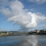
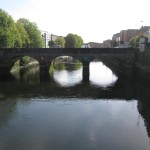
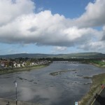
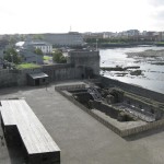
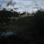
- River Shannon with King John’s.
-
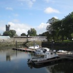
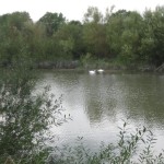
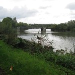
- Walk by the River.
-
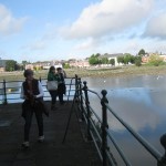
- Walk by the River.
-
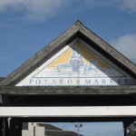
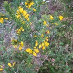
- Typical Ireland and Potatoes.
-
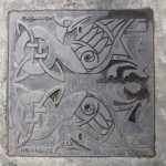
- Man-hole cover.
-
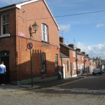
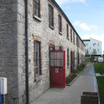
- Interesting brick buildings.

-
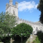
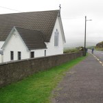
- St Mary’s Cathedral
-
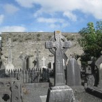
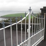
- Graveyard outside.
-
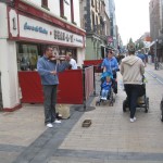
- Street musicians with a fiddle.
-
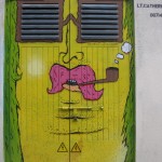
- Interesting doors.
-
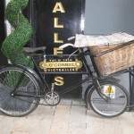
- Interesting bike.
-
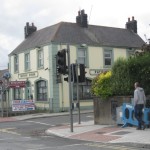
- The corner to remember getting out of town.
-
- Hunt Museum.
-
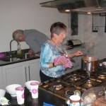
- Carol in charge.
-
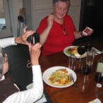
- Everyone had a job.

-
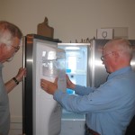
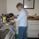
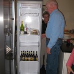
- The two guys broke the ice maker. Go figure!
-
- Lynn calling home for news.
-

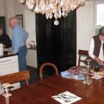
- After dinner web searching.

[`google_buzz` not found]
[`yahoo` not found]
[`livedoor` not found]
[`friendfeed` not found]
[`tweetmeme` not found]
Thatched-Roof Fairyland
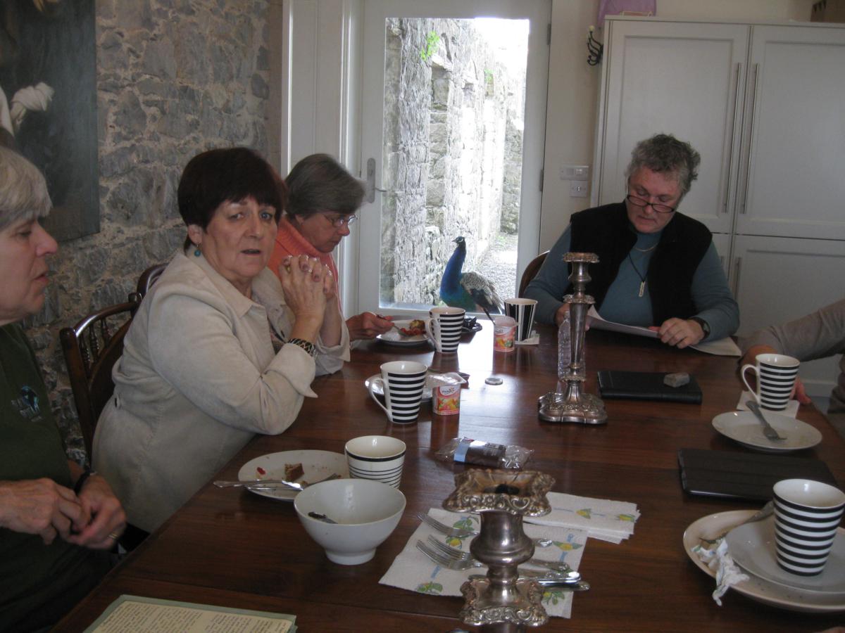
Tuesday, October 2, 2013. The day started with a leisurely breakfast around the huge pine table built for an army. The kitchen in the East Tower continued to serve as our gathering place, morning, noon or night. This morning the kitchen table was an exceptionally nice place to gather. Elvis (the previously no-name peacock who lost his mate the month before) was greeting us at the backdoor as if to say, “Hey you guys! I’m part of this party too, you know!” The sun was shining brightly, a welcoming sight. Everyone took their time getting up and about this morning; all of us were still recovering from the previous full day of driving around the Ring of Kerry.
Our schedule called for a drive around the Dingle Peninsula, but a committee suggestion with a unanimous vote called for a day of exploring the towns closer to the castle. We chose to see Kilmallock, only thirty minutes away and then to drive a short distance north and see Adare before making our way back to the castle.
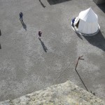
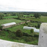
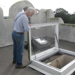
Because the day was sunny and warm we took the opportunity to climb to the roof of the East Tower in Springfield Castle. By this time John and Pat were used to climbing three stories to their room, Harriet and Rob two stories, but the rest of us were intrigued by the beautiful staircase and were anxious to climb that last stepladder. It really was a stepladder, not really steps and much more substantial than a ladder. The view up top was spectacular! Camera-clicking battled with bird-chirping.
The day started with a leisurely breakfast around the huge pine table built for an army. The kitchen in the East Tower continued to serve as our gathering place, morning, noon or night. This morning the kitchen table was an exceptionally nice place to gather. Elvis (the previously no-name peacock who lost his mate the month before) was greeting us at the backdoor as if to say, “Hey you guys! I’m part of this party too, you know!” The sun was shining brightly, a welcoming sight. Everyone took their time getting up and about this morning; all of us were still recovering from the previous full day of driving around the Ring of Kerry.
Our schedule called for a drive around the Dingle Peninsula, but a committee suggestion with a unanimous vote called for a day of exploring the towns closer to the castle. We chose to see Kilmallock, only thirty minutes away and then to drive a short distance north and see Adare before making our way back to the castle.
Because the day was sunny and warm we took the opportunity to climb to the roof of the East Tower in Springfield Castle. By this time John and Pat were used to climbing three stories to their room, Harriet and Rob two stories, but the rest of us were intrigued by the beautiful staircase and were anxious to climb that last stepladder. It really was a stepladder, not really steps and much more substantial than a ladder. The view up top was spectacular! Camera-clicking battled with bird-chirping.
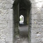
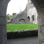
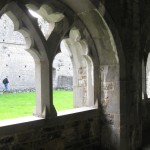
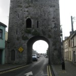
After all the “Kodak-Moments” we made our way to Kilmallock, a walled-town in south County Limerick with a Dominican Priory and King John's Castle that looked interesting, as well as visible remains of medieval walls. The town, founded in the sixth and seventh century was an important religious, trade, and commerce center and a noted location in the late medieval period forward. It was strategically located during war times from 1571, 1577, and 1648 and in more recent times in 1922 during the Irish Civil War. Another sectarian campaign occurred in July 1935, when arsonists burned the Church of Ireland building to the ground. I’m learning that Ireland has had more than its fair share of conflict.
King John’s Castle, a four-story tower that may have been part of the northern gate to the town at one time, was situated in the middle of the street and rather than work that puzzle, we just pulled into the first place we came to, an obscure lot behind a market, down a one way street. While I was planning the trip, I had read about the possibilities of a theatre performance at Friars Gate Theatre. There it was on Main Street, as we made our way along the unique passage of Mom and Pop stores of every notion. This was an excellent first stop. The Friars Gate Theatre also doubles as a quasi-tourism office. Unfortunately there were no performances scheduled during our stay, but a very pleasant lady gave us a self-guided walking map and as much information as one could handle in a quick briefing.
Much to my chagrin, in the middle of touring the ruins, I had completely filled the four memory cards for my camera. These were the same cards I had carried along to France and Spain on trips only a year earlier. What gives? I know I was, and still am, smitten with Ireland, but really, that many pictures!? I stopped a young couple on the street to inquire about where I might find another memory card. They were as friendly and helpful as everyone else we had met in Ireland. They pointed to a hardware store at the end of the street. I was skeptical, but sure enough, when I went in, the wonderful person behind the counter looked at my camera and produced exactly what I needed. It cost me 35 Euros (about $45), but I was desperate. It is 32GB. I hope that means it has a lot of capacity. We still had several days left on the trip and the artist in me would not be happy without a camera in my hand. This is the same point-and-shoot-camera in which the hinge on the battery portal had given out early on this trip. I was determined to hobble along with the rubber band holding the door tight enough to make contact with the batteries and holding my mouth just right to get the perfect shots.
Armed with plenty of memory card space, a fresh rubber band to hold the batteries in my camera, and plenty of mental visuals of Kilmallock, we were ready to drive on to Adare. Adare, located south of Limerick is regarded as Ireland's prettiest and most picturesque village. Situated on the river Maigue, a tributary of the river Shannon, Adare has a rich history of rebellions, wars and conquests dating back to 1200 AD.
It would have been an easy drive from Kilmallock, but we were traveling on those narrow Irish roads much of the way and today of all days those narrow roads were receiving road work. We made our way patiently along and conveniently parked in the Adare Heritage Centre and Tourist Office.
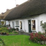
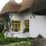
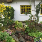
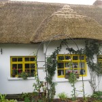
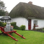
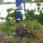
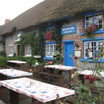
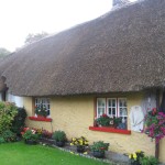
We made our way through the Centre onto Main Street. I was immediately transported into Grimm’s Hansel and Gretel fairyland. The street was dotted with beautiful stone buildings, medieval monasteries, ruins and colorful thatched-roof cottages . I know that book was written by German authors and I was in Ireland, but the little book in my head from childhood was screaming Hansel and Gretel.
The original thatched cottages have survived for hundreds of years. Most of the cottages are kept by local restaurants, arts and crafts shops and delightful tourism traps, but some are still privately owned. In the early 19th century, the Earl of Dunraven laid the plan for the existing streets and townhouses of Adare. The lands and dwellings were rented to tenants. Today, the village is an architectural treasure of scenic beauty.
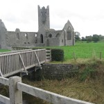
Angie and I stopped in the Blue Door Restaurant for a spot of tea and a leisurely chat. We window shopped and made our way into several of the touristy-priced shops but enjoyed our stroll along the walking trail the most. The trail took us along the River Maigue by Desmond Castle built in 1202. We passed the Augustinian Priory, the Franciscan Friary, and several other interesting sites. We circled the backside of the village, made our way back to Main Street and sat in the Adare Town Park. We watched locals play with their dogs and children before we joined everyone at the designated time back at the Heritage Centre. We bought a few souvenirs and drove back to the castle. An enchanting day of relaxing touring!

 The day started with a leisurely breakfast around the huge pine table built for an army. The kitchen in the East Tower continued to serve as our gathering place, morning, noon or night. This morning the kitchen table was an exceptionally nice place to gather. Elvis (the previously no-name peacock who lost his mate the month before) was greeting us at the backdoor as if to say, “Hey you guys! I’m part of this party too, you know!” The sun was shining brightly, a welcoming sight. Everyone took their time getting up and about this morning; all of us were still recovering from the previous full day of driving around the Ring of Kerry.
Our schedule called for a drive around the Dingle Peninsula, but a committee suggestion with a unanimous vote called for a day of exploring the towns closer to the castle. We chose to see Kilmallock, only thirty minutes away and then to drive a short distance north and see Adare before making our way back to the castle.
Because the day was sunny and warm we took the opportunity to climb to the roof of the East Tower in Springfield Castle. By this time John and Pat were used to climbing three stories to their room, Harriet and Rob two stories, but the rest of us were intrigued by the beautiful staircase and were anxious to climb that last stepladder. It really was a stepladder, not really steps and much more substantial than a ladder. The view up top was spectacular! Camera-clicking battled with bird-chirping.
The day started with a leisurely breakfast around the huge pine table built for an army. The kitchen in the East Tower continued to serve as our gathering place, morning, noon or night. This morning the kitchen table was an exceptionally nice place to gather. Elvis (the previously no-name peacock who lost his mate the month before) was greeting us at the backdoor as if to say, “Hey you guys! I’m part of this party too, you know!” The sun was shining brightly, a welcoming sight. Everyone took their time getting up and about this morning; all of us were still recovering from the previous full day of driving around the Ring of Kerry.
Our schedule called for a drive around the Dingle Peninsula, but a committee suggestion with a unanimous vote called for a day of exploring the towns closer to the castle. We chose to see Kilmallock, only thirty minutes away and then to drive a short distance north and see Adare before making our way back to the castle.
Because the day was sunny and warm we took the opportunity to climb to the roof of the East Tower in Springfield Castle. By this time John and Pat were used to climbing three stories to their room, Harriet and Rob two stories, but the rest of us were intrigued by the beautiful staircase and were anxious to climb that last stepladder. It really was a stepladder, not really steps and much more substantial than a ladder. The view up top was spectacular! Camera-clicking battled with bird-chirping.
-
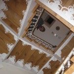
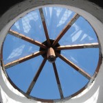
- The staircase in the East Tower.
-
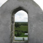
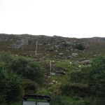
- Beyond the walls.
-
- Come on up!
-
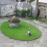
- The view of the gournds.
-
- Was this for a bell?
-
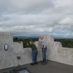
- Harriet and Rob in a Kodak moment.
-
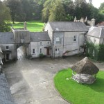
- Another view of the courtyard.
-
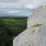
- Another beyond the walls shot.
-
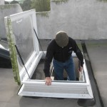
- I want in on the action.


[`google_buzz` not found]
[`yahoo` not found]
[`livedoor` not found]
[`friendfeed` not found]
[`tweetmeme` not found]
Ring Around Authentic Ireland
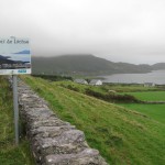
Authentic experiences and letting the day take you on the journey - my preferred means of travel. On Monday, September 30, 2013, our group was scheduled to visit the Ring of Kerry, a tourist trail and part of the mystical, unspoiled region of Ireland. The travel photos of the peninsula were spectacular. The Ring of Kerry, among other things, features the ancient heritage of Ireland from the Iron Age Forts and Ogham Stones, to old monasteries and a landscape carved out of rock by the last Ice Age 10,000 years ago.
It was a typical Irish weather day for September, a little overcast, but pleasantly warm. The beginning of the trail was only thirty or forty minutes from our castle. We knew we would be driving all day, stopping intermittently to see the sights. As long as we could see beyond the hood of the car, we were good.
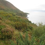
That day certainly took us on the journey. Carpe diem, as they say in Rome. We all relaxed for a day of “what-ever”. We meandered along so well in fact, finding those authentic experiences, that we meandered until after dark without getting all the way around the Ring. The idea for seeing the Ring of Kerry is to travel counter-clockwise around the peninsula. By the way, this is another of those roads that is winding and narrow. However, this winding, narrow road skirts the ocean, high on a cliff with crashing waves below on many of the miles. I think this may be the reason that the guidebooks suggest the counter-clockwise travel – everybody traveling the same way may reduce head-on collisions.
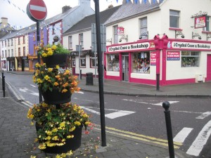

 The route from our castle took us through Killorglin. As we crossed the bridge over the River Laune, I saw a beautiful bronze sculpture of a goat. He was no ordinary goat. He was a Billy Goat standing tall, with handsome horns, guarding the entrance to the town. We had not planned on stopping in this town. We hadn’t actually reached the Ring of Kerry. We crossed the beautiful rock bridge with Roman arches and were taken away with the beauty of the town. The colors of the buildings, set side by side, up and down the steep streets said, “Stop and visit! You’ll love it here!” So stop, we did.
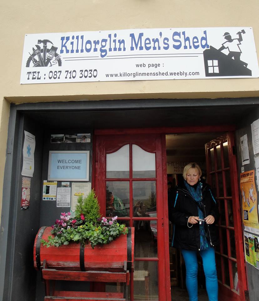
By that time of the morning, we were all ready for a second cup of coffee and a scone. We sat a time to meet back at the parking lot and all went our merry way. Well, almost. I saw a sign on a building off the parking lot, “Killorglin Men’s Shed”. I was intrigued. I approached the shed and a very pleasant, friendly MAN stepped outside the door. He was too friendly to be barring me from entering, so enter, I did. The whole entourage came along. We were all intrigued. The gentleman gave us a tour of the facility and explained the concept. It was ingenious. The shed was filled with woodworking tools and the men paid a membership fee each month to be able to use the shed with its well-appointed assortment of tools. Tools are expensive. Sheds to work in are limited. Sharing the expenses and the camaraderie and learning from each other is a perfect solution. I think this is a concept that should be copied and opened up to women. This was a chance happening that we all enjoyed.
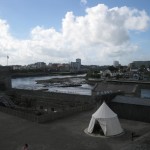
We scattered around town to shop for another few minutes. I stopped at the fruit and veggie stand to get the fixings for tomorrow morning’s omelets. I stood there under the blue-tarp roof feeling very comfortable reading the signs for the produce. Normally when shopping in counties in Europe and now Ireland I’m busy in my head converting pounds to kilograms and Euros to dollars. It dawned on me! These signs were written both ways. The farmer told me that when Ireland converted to the metric system, formally in 1993, that many of the older population didn’t like the new system and he had always measured the fruit and veggies either way. I was impressed at how quickly he made those conversions in his head. Wish my math were as easy for me. I suppose if I did it every day and several times a day, it would be easier.
The route from our castle took us through Killorglin. As we crossed the bridge over the River Laune, I saw a beautiful bronze sculpture of a goat. He was no ordinary goat. He was a Billy Goat standing tall, with handsome horns, guarding the entrance to the town. We had not planned on stopping in this town. We hadn’t actually reached the Ring of Kerry. We crossed the beautiful rock bridge with Roman arches and were taken away with the beauty of the town. The colors of the buildings, set side by side, up and down the steep streets said, “Stop and visit! You’ll love it here!” So stop, we did.
By that time of the morning, we were all ready for a second cup of coffee and a scone. We sat a time to meet back at the parking lot and all went our merry way. Well, almost. I saw a sign on a building off the parking lot, “Killorglin Men’s Shed”. I was intrigued. I approached the shed and a very pleasant, friendly MAN stepped outside the door. He was too friendly to be barring me from entering, so enter, I did. The whole entourage came along. We were all intrigued. The gentleman gave us a tour of the facility and explained the concept. It was ingenious. The shed was filled with woodworking tools and the men paid a membership fee each month to be able to use the shed with its well-appointed assortment of tools. Tools are expensive. Sheds to work in are limited. Sharing the expenses and the camaraderie and learning from each other is a perfect solution. I think this is a concept that should be copied and opened up to women. This was a chance happening that we all enjoyed.
We scattered around town to shop for another few minutes. I stopped at the fruit and veggie stand to get the fixings for tomorrow morning’s omelets. I stood there under the blue-tarp roof feeling very comfortable reading the signs for the produce. Normally when shopping in counties in Europe and now Ireland I’m busy in my head converting pounds to kilograms and Euros to dollars. It dawned on me! These signs were written both ways. The farmer told me that when Ireland converted to the metric system, formally in 1993, that many of the older population didn’t like the new system and he had always measured the fruit and veggies either way. I was impressed at how quickly he made those conversions in his head. Wish my math were as easy for me. I suppose if I did it every day and several times a day, it would be easier.
I saw several faded signs in Killorglin for a Puck Fair. I found out later that the town is famous for the so-claimed World’s Oldest Fair held in August each year. Legend suggest an origin for the Fair (no written record) dating back to a charter from 1603 by King James I granting legal status to the then existing fair in Killorglin. The goat could be linked to a pre-Christian harvest celebration and the male goat “Puck”, a pagan symbol of fertility, like the pagan god Pan.
Another story relating to the origin of King Puck connects him to Oliver Cromwell’s English army who were pillaging the countryside. They came across a herd of grazing goats and the animals ran before the raiders could capture them. The he-goat or “Puck” broke away. While the other goats headed for the mountains, Puck went towards Killorglin. He arrived exhausted but alerted the town of the danger and they were able to protect themselves. The people decided to organize a special festival in his honor and this festival has been held ever since. I’ve got to go back in August. The website http://puckfair.ie/ looks exciting.
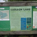
The troops gathered and we rambled on. We were skirting the MacGillycuddy's Reeks, meaning black stacks, the highest mountain range in Ireland. I can’t help but think of I Love Lucy each time I read about the MacGillycuddy Range. We decided to drive up a mountain path for a view of the Caragh Lake, glacial in origin. It was somewhat overgrown and the view was just “ok”. I’m glad we didn’t run into traffic on that climb or we would have been backing down the mountain. A couple of young girls, tourists too, also driving a rental car, followed us up the path. I think they were as lost as we were. Nothing much on that path. Someone had been camping at the site. There was campfire gear scattered on the table. On hindsight, we all wished we had skipped this brown scenic marker.
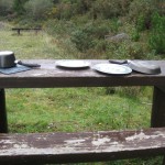
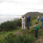
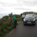
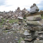
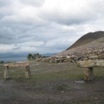
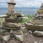
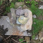
On the Ring between Cahersiveen and Glenbeigh is a village called Kells, where we stopped at Pat’s Craft Shop and Quarry Restaurant. We found some lovely top quality gifts, but decided not to eat again so soon. As we made our way up that particular mountain, we stopped one more time for a view and the rock cairns, piles of stones erected to define a path or mark a memorial. We’re not sure if this had some significance or not, but we took the opportunity to make our own cairn and have a group prayer.
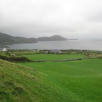
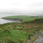
As we made our way around the Ring, stopping several times for pictures of one thing or another, including the Dingle Peninsula across the bay, we were all getting hungry, AGAIN. We came to the small seaside village of Waterville on the edge of the Atlantic Ocean with a glorious backdrop of lush, rugged mountains. As we’re gazing out on the shores of Lough Currane (Lake Currane) or the Atlantic – I can’t remember whether we were looking north or south - we came face to face with Charlie Chaplin, an American master comedian and filmmaker. A bronze sculpture of Charlie Chaplin in Ireland. Who would have thought it?
Back in his day, Charlie Chaplin fell in love with this idyllic, picturesque location and visited Waterville for many years with his wife Oona and their children. According to members of the Chaplin family, Waterville gave him a tranquil place where he could enjoy spending time with his family in anonymity. Now the town holds a Charlie Chaplin Comedy Film Festival. The fourth annual festival will be in August 2014, the first supported by his daughter, Josephine Chaplin. Their aim is for the Charlie Chaplin Comedy Film Festival to become an international event.
We ambled along the quaint streets and found our truly “authentic experience” for the day. An Corcan (meaning black pot) Restaurant that opened in 1996! The restaurant, small and causal, is owned and run by Fiona and Dan Fitzpatrick, both from Waterville. I say authentic because Fiona is the epitome of what I think when someone says “Irish”- a very friendly redhead. I had her traditional Old Style Fish & Chips with her homemade tartar sauce. I don’t like tartar sauce, but she made a believer out of me and even gave me the recipe.
Fiona holds another trait of what I consider “Irish”; she is a wonderful storyteller. While we’re all swallowing our tongues from her homemade Irish Soda Bread, she told us about the day she was awarded a medal (and I think cash prize) for the best bread in south Ireland. A local radio station had a contest and she decided to enter. She was one of 7,000 entrants. On the day of the announcement, the DJ was driving to the home of the winner, giving clues to where he was all along the way. She was tuned in. She thought early on, “Oh, he’s in our region.” He traveled on. She listened on. She thought again, “Oh, he’s on the Ring of Kerry”. As the day went on, she became more and more excited, thinking to herself, “I’m so happy someone near me is going to win.” He was headed to the An Corcan to give Fiona the prize. We all concur with the judges. It was the best Irish Soda Bread we ate the whole time we were in Ireland. We took several loaves back to the castle for the days ahead. Fiona explained to Lynn, our resident bread baker, the secrets to her award winning bread. For our Get-Back-Together party in the states, Lynn tried out three different recipes and again, Fiona’s bread recipe won out.
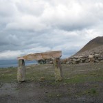
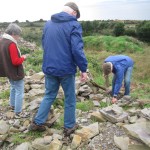
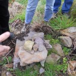
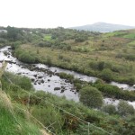
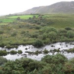
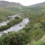
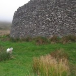
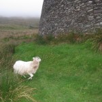
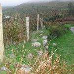
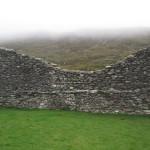
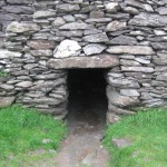
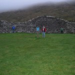
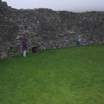
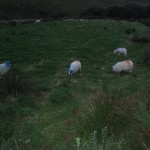
Our last wanderings that day took us up another dirt path to the Staigue or Staig Fort, a partly ruined stone ringfort, thought to have been built during the late Iron Age, probably between 300 and 400 AD. It was probably a defensive stronghold for a local king. We drove up a valley, climbed through a fence and made our way through a pasture full of red and blue-marked sheep and over the ditch that surrounded the fort. We climbed inside the fort through a tiny passage under double beamed stones. The Staigue was built without mortar, using undressed stones. The walls are about 18 feet high in places and 13 feet thick at the bottom. Inside is an elaborate network of stairways leading to terraces and corbelled cells in the walls. I found stones on the ground around the circle with numbers 1-8 carved on them. I had everyone stand on the pavers to get a feel for what they were used for, but I’m still not sure. It appears to be a place of worship. I feel like there were ceremonies held there, either then or maybe now.
The sun had set by the time we finished exploring that interesting place and we still had two or three hour’s drive to get back to the castle. It was a dark and stormy night and the wind blew and the road twisted and turned in the fog. Most of that statement was true, but luckily, it wasn’t storming. The mossy tree-lined road over the remainder of the Ring gave us a feeling of riding through one of the darker Grimm’s Fairy Tales. We made it back to the castle without an incident and ready for a good night’s rest and another day of exploring southwest Ireland.


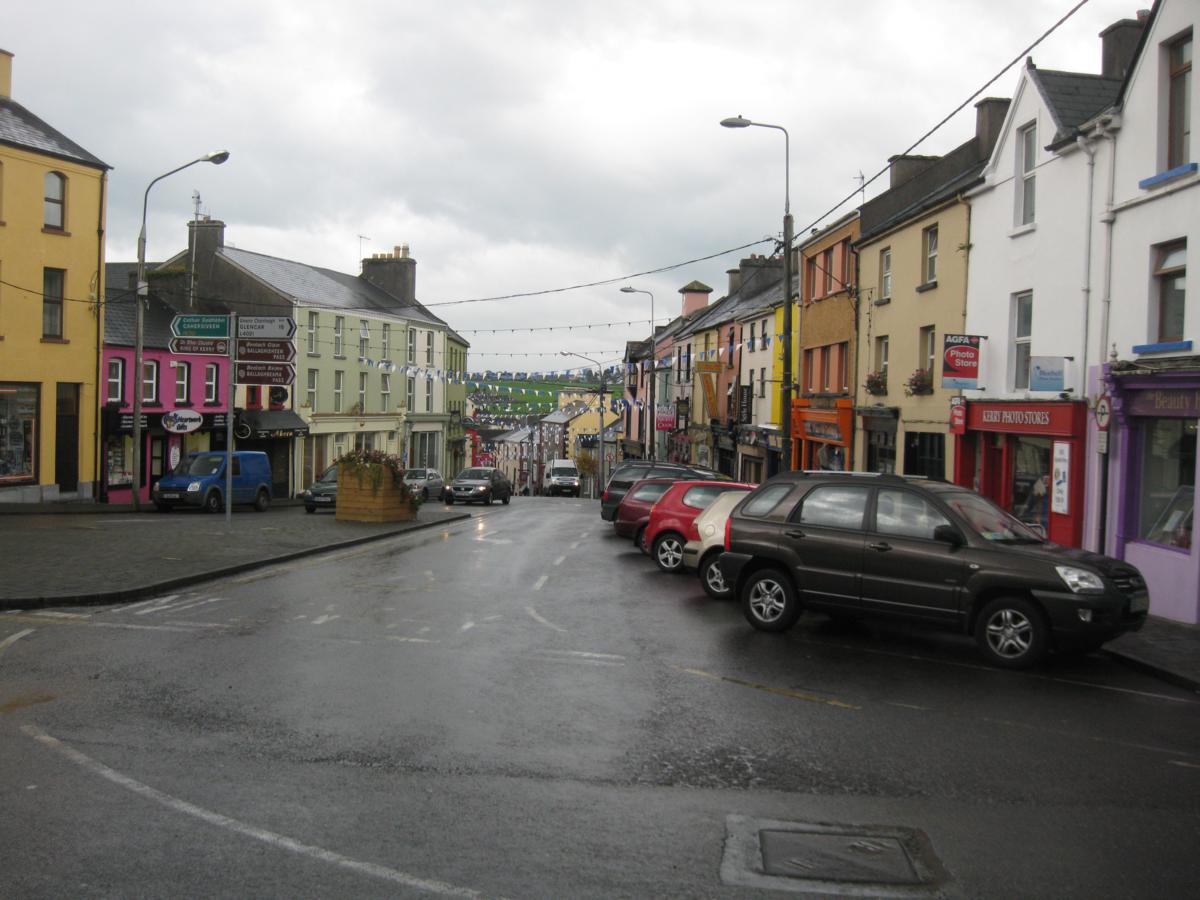
 The route from our castle took us through Killorglin. As we crossed the bridge over the River Laune, I saw a beautiful bronze sculpture of a goat. He was no ordinary goat. He was a Billy Goat standing tall, with handsome horns, guarding the entrance to the town. We had not planned on stopping in this town. We hadn’t actually reached the Ring of Kerry. We crossed the beautiful rock bridge with Roman arches and were taken away with the beauty of the town. The colors of the buildings, set side by side, up and down the steep streets said, “Stop and visit! You’ll love it here!” So stop, we did.
By that time of the morning, we were all ready for a second cup of coffee and a scone. We sat a time to meet back at the parking lot and all went our merry way. Well, almost. I saw a sign on a building off the parking lot, “Killorglin Men’s Shed”. I was intrigued. I approached the shed and a very pleasant, friendly MAN stepped outside the door. He was too friendly to be barring me from entering, so enter, I did. The whole entourage came along. We were all intrigued. The gentleman gave us a tour of the facility and explained the concept. It was ingenious. The shed was filled with woodworking tools and the men paid a membership fee each month to be able to use the shed with its well-appointed assortment of tools. Tools are expensive. Sheds to work in are limited. Sharing the expenses and the camaraderie and learning from each other is a perfect solution. I think this is a concept that should be copied and opened up to women. This was a chance happening that we all enjoyed.
We scattered around town to shop for another few minutes. I stopped at the fruit and veggie stand to get the fixings for tomorrow morning’s omelets. I stood there under the blue-tarp roof feeling very comfortable reading the signs for the produce. Normally when shopping in counties in Europe and now Ireland I’m busy in my head converting pounds to kilograms and Euros to dollars. It dawned on me! These signs were written both ways. The farmer told me that when Ireland converted to the metric system, formally in 1993, that many of the older population didn’t like the new system and he had always measured the fruit and veggies either way. I was impressed at how quickly he made those conversions in his head. Wish my math were as easy for me. I suppose if I did it every day and several times a day, it would be easier.
The route from our castle took us through Killorglin. As we crossed the bridge over the River Laune, I saw a beautiful bronze sculpture of a goat. He was no ordinary goat. He was a Billy Goat standing tall, with handsome horns, guarding the entrance to the town. We had not planned on stopping in this town. We hadn’t actually reached the Ring of Kerry. We crossed the beautiful rock bridge with Roman arches and were taken away with the beauty of the town. The colors of the buildings, set side by side, up and down the steep streets said, “Stop and visit! You’ll love it here!” So stop, we did.
By that time of the morning, we were all ready for a second cup of coffee and a scone. We sat a time to meet back at the parking lot and all went our merry way. Well, almost. I saw a sign on a building off the parking lot, “Killorglin Men’s Shed”. I was intrigued. I approached the shed and a very pleasant, friendly MAN stepped outside the door. He was too friendly to be barring me from entering, so enter, I did. The whole entourage came along. We were all intrigued. The gentleman gave us a tour of the facility and explained the concept. It was ingenious. The shed was filled with woodworking tools and the men paid a membership fee each month to be able to use the shed with its well-appointed assortment of tools. Tools are expensive. Sheds to work in are limited. Sharing the expenses and the camaraderie and learning from each other is a perfect solution. I think this is a concept that should be copied and opened up to women. This was a chance happening that we all enjoyed.
We scattered around town to shop for another few minutes. I stopped at the fruit and veggie stand to get the fixings for tomorrow morning’s omelets. I stood there under the blue-tarp roof feeling very comfortable reading the signs for the produce. Normally when shopping in counties in Europe and now Ireland I’m busy in my head converting pounds to kilograms and Euros to dollars. It dawned on me! These signs were written both ways. The farmer told me that when Ireland converted to the metric system, formally in 1993, that many of the older population didn’t like the new system and he had always measured the fruit and veggies either way. I was impressed at how quickly he made those conversions in his head. Wish my math were as easy for me. I suppose if I did it every day and several times a day, it would be easier.
-
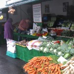
- Farmers Market-Metric or Imperial
-
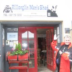
- Angie likes this place too.
-
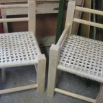
- Work from the shed.
-
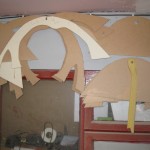
- Patterns.
-
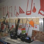
- An assortment of tools.
-
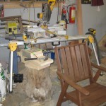
- What a mess! LOL
-

- Our gracious guide.
-
- Is this from Goldilocks?
-
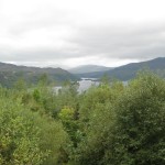
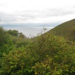
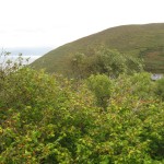
- Not much of a view.
-
- What artistic skill!
-
- Gathering stones.
-
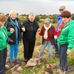
- Our prayer cairn.
-
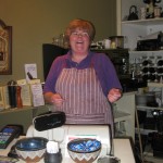
- Fiona!
-
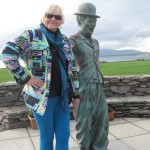
- Charlie Chaplin.
-
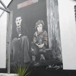
- Mural of Charlie Chaplin.
-
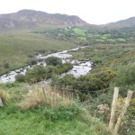
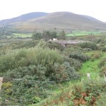
- The valley along the drive to the ringfort.
-
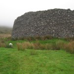
- Sheep grazing on the outside.
-
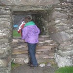
- Squeezing through the opening.
-
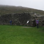
- Inside at the designated points.
-
- Getting dark. Time to go.

[`google_buzz` not found]
[`yahoo` not found]
[`livedoor` not found]
[`friendfeed` not found]
[`tweetmeme` not found]